|
Written By:
LAN Associates 6 Common Types of Land Surveys Before architects and engineers can start the conceptual design phase of a property development project, they need to understand the land they are building on. This is where land surveyors come in. They determine what type of land survey you need and then map the parcel of land to define its boundaries, topography, and other features. This vital first step informs many subsequent project decisions, so it is important to understand the process. Below is a quick primer on the common types of land surveys. This guide will help you identify what to expect during this key step in the property development process. Boundary Surveys: Boundary surveys are conducted to establish or re-establish and document the precise boundaries of the land a project will be built on. This includes measuring and mapping the land’s corners, lines, and monuments to determine the limits of the property. Boundary surveys are a vital part of buying and selling property and resolving disputes about where property starts and ends. If you want to put up a fence or any other structure close to property lines, you need a boundary survey to help guide your project. Topographic Surveys: Topographic surveys map the natural and artificial features of a piece of property. The goal of a topographic survey is to provide detailed information about the contours, elevations, vegetation, water bodies, structures, and other characteristics of the land. This type of survey provides a comprehensive understanding of terrain which is vital for site development and landscape design. ALTA/NSPS Land Title Surveys: ALTA/NSPS (American Land Title Association/National Society of Professional Surveyors) Land Title Surveys, commonly referred to as “ALTA’s”, are detailed surveys conducted during real estate transactions. They follow strict standards and provide a host of information about boundaries, easements, encroachments, and zoning restrictions. Insurance and title companies often require ALTA surveys to determine if there are any potential risks associated with the property. Construction Surveys: If you are going to perform construction, you will likely need a construction survey to assist with the planning and execution of your project. A construction survey helps establish precise locations, elevations, and dimensions for project features like structures, roads, and utilities. The survey crew will take the proposed information depicted on the approved construction plans and place markers in order to relate them to the actual location on the particular property. This type of survey helps ensure accuracy during the building process, and it helps the architecture and engineering teams implement their designs and specifications in line with legal requirements. Subdivision Surveys: When dividing a large parcel of land into smaller lots, you need a subdivision survey. This helps determine the boundaries, dimensions, and legal descriptions of individual parcels of land. Subdivision surveys are common when new neighborhoods are planned in urban development and for dividing up land for sale or for development purposes. Elevation Certificates: An elevation certificate is a document that provides information regarding a building’s location, lowest point of elevation, flood zone and other characteristics, according to the Federal Emergency Management Agency (FEMA). These elevations must be tied to the same datum as shown on the existing FEMA mapping and the certificates are currently utilized for flood insurance purposes or during the building process for new buildings in flood-prone areas. What Should I Do if I Need a Survey? Whether you are building a single-family residential house, a municipal building, or a K-12 school, it’s essential to start your project off with a proper understanding of the land you are building on. LAN Associates has a dedicated team of surveyors with decades of multi-sector experience who can help you determine what type of survey you need and then execute the needed work.
0 Comments
Written By:
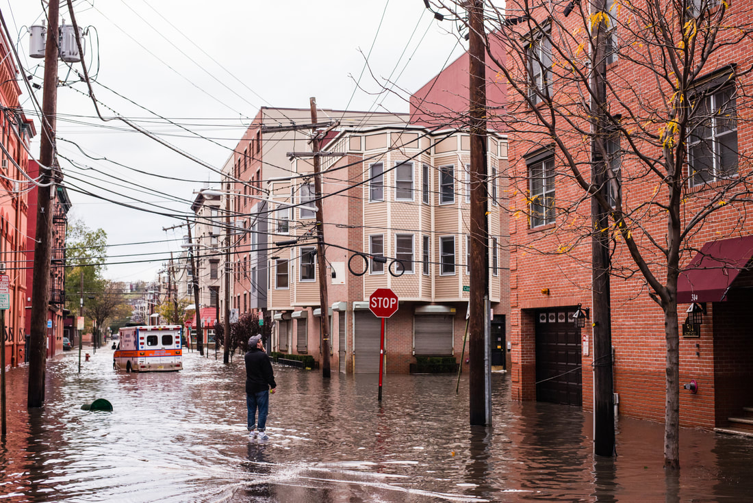
LAN Associates If you are planning on building in New Jersey, you may need to take a second look at your building site or proposed addition to make sure it’s not in a newly defined flood hazard zone. The New Jersey Department of Environmental Protection (NJDEP) recently finalized regulatory updates to the Flood Hazard Area Control Act Rules and Stormwater Management Rules. The updated rules are significantly more stringent as a response to the challenges presented by climate change and the need for resiliency. The updated regulations make New Jersey the first state to use predictive precipitation modeling to regulate future development and redevelopment to protect against the impacts of climate change and the resulting worsening riverine flooding, stormwater runoff, and flooding of the built environment. This adds a new layer of challenge for development that will require the expertise of Land Use Professionals to calculate runoff for both the storms of today and the future. What Do the New Rules Mean for Your Current and Future Projects? For developers and homeowners who wish to develop their properties, the new Flood Hazard Area Control Act (FHACA) rules increase the land area that is subject to the requirements of the FHACA by proposing new regulatory flood elevations. This means many properties and building sites that were not in a flood zone before are now considered at risk of flooding. Currently, there is no publicly available mapping to guide developers in making sure they are following the updated regulations, so it is imperative that you contact a Land Use Professional to help you through the process. Explanation of the Changes The 100-year flood event established by Federal Emergency Management Agency (FEMA) will have a greater factor of safety added to the Flood Hazard Area Flood Elevation. The current factor of safety is one foot added to the FEMA flood hazard area elevation; the new rules will add an additional two feet, totaling a three-foot factor of safety. Also, the NJDEP studied stream elevations will increase by one foot in addition to the one foot that the NJDEP already requires, totaling a two-foot increase. Additionally, under the new rules, the design of all stormwater management facilities for all proposed land development projects in the State of New Jersey will be required to account for higher intensity rainfall by incorporating greater depths of precipitation for the 2-, 10-, and 100-year storm events for both current and predicted future storm events. This comes after the March 2021 amendment to the Stormwater Management Rules, which set forth requirements for green infrastructure practices to be utilized throughout a site. Using updated rainfall events in these designs will establish a more adept stormwater management system mimicking the natural hydrologic cycle. What is LAN Doing to Ensure Our Projects Comply? Unless you have already poured the foundation, the new regulations will likely be enforced on your project. LAN’s team of land use professionals are working with members of our architectural and engineering teams to ensure that this issue is addressed in all current and future LAN projects. We are examining which projects might be exempt and acting on all projects that need to be modified. What Should I do if I Have an Upcoming Project That is Not Being Handled by LAN? If you are planning a construction project and are unsure if the new flood hazard rules will impact that project, you can contact LAN to work with a member of LAN’s Land Use Department. Our team can assess your property and help you understand if any action needs to be taken to avoid delays or issues with your development project. |
Guest Blog
Archives
July 2024
Categories |
- About Us
- Events & Programs
-
Forums
- Diversity, Equity & Inclusion Forum
- Environmental Business Council
- Family-Owned Business Forum
- Healthcare Foum
- Higher Education Forum
- Human Resources Forum
- International Forum
- Manufacturing Forum
- Marketing Forum
- Next Gen: A Young Professionals Organization
- Non-Profit Forum
- Real Property Forum
- Technology for Business Forum
- Transportation Forum
- Women in Commerce Forum
- Membership
- COMMERCE Magazine
- Member Directory
- Member News
- Guest Blog
|
Copyright Commerce and Industry Association of New Jersey. All Rights Reserved.
365 West Passaic Street Suite 490 | Rochelle Park, NJ 07662 Phone: (201) 368-2100| [email protected] | sitemap |


 RSS Feed
